I prefer paper maps and a compass, not just because they don’t require a phone or GPS signal but for the viewable distance a map provides. I have never seen a hand held mapping device that displays a sufficient readable area.
The only problem with maps is that they are useless unless your know your position. For this I want a device that just gives me a grid reference. Using a phone app to determine this is not safe as it is guaranteed that when you need it you wont have a phone signal.
There are no simple GPS devices available that just provide a position as the manufactures want to sell more expensive products that include maps. My solution is to use the cheapest device on the market and ignore all the features other than the page that displays the grid reference. Currently this is the Garmin eTrex 10.
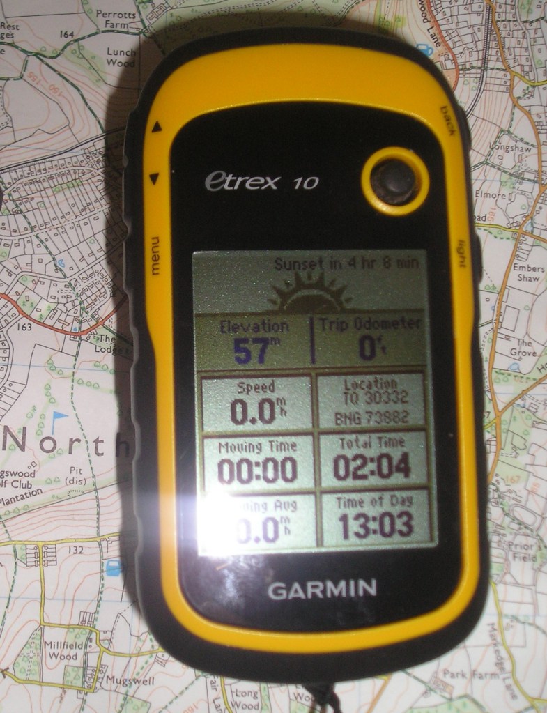
As well as showing the Ordnance Survey grid reference this also displays useful information such as distance walked and walking speed.
To display the OS grid reference (BNG, British National Grid, in the image) the device needs configuring to use British Grid as the Position Format and Ord Srvy GB as the Map Datum. It is also useful to change the Distance and Speed setting to Statute.
